Planning Better for Vaccination in Rural and Semi-Urban Areas Using Data and GIS

Introduction
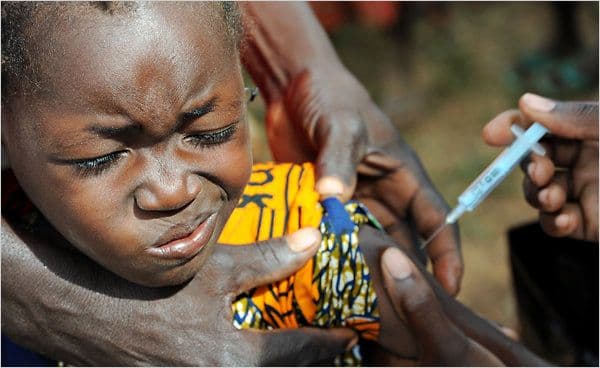
Vaccination is a critical public health intervention that prevents the spread of infectious diseases. However, ensuring effective vaccination coverage in rural and semi-urban areas presents significant challenges, including logistical constraints, lack of awareness, and inadequate health infrastructure. Leveraging data and Geographic Information Systems (GIS) can enhance planning, implementation, and monitoring of vaccination programs, leading to increased efficiency and better health outcomes.
Challenges in Vaccination Planning
- Geographical Barriers – Remote locations and poor transportation networks hinder vaccine distribution, making it difficult to reach all target populations.
- Data Gaps – Lack of real-time population data and inaccurate census records make it difficult to estimate vaccine needs accurately, leading to either shortages or surpluses.
- Cold Chain Management – Maintaining vaccines at optimal temperatures in areas with unreliable electricity and insufficient refrigeration poses logistical challenges.
- Health Workforce Shortages – Rural and semi-urban areas often lack sufficient trained health workers to administer vaccines effectively, impacting coverage rates.
- Low Public Awareness and Misinformation – Cultural beliefs, myths, and misinformation can lead to vaccine hesitancy, reducing uptake rates.
- Monitoring and Accountability Issues – Tracking vaccine distribution and administration is difficult in decentralized health systems, leading to potential wastage and inefficiencies.
- Funding Constraints – Limited financial resources hinder the expansion of vaccination programs, especially in low-income communities.
The Role of Data in Vaccination Planning
Data-driven approaches can improve vaccination campaigns by:
- Mapping Population Distribution – Using census data, satellite imagery, and health records to identify target populations, ensuring comprehensive coverage.
- Estimating Vaccine Demand – Analyzing demographic and epidemiological data to predict vaccine requirements for different regions and prevent shortages.
- Tracking Immunization Coverage – Using health records and digital registries to monitor who has received vaccinations and identify gaps in coverage.
- Optimizing Supply Chain Management – Using logistics data to ensure efficient vaccine storage, transportation, and delivery while minimizing wastage.
- Assessing Vaccine Hesitancy Trends – Collecting survey data to understand reasons for low vaccination rates and designing targeted outreach programs tailored to specific communities.
- Enhancing Outbreak Response – Real-time disease surveillance data can help health authorities deploy vaccines more effectively in response to emerging outbreaks.
Leveraging GIS for Enhanced Vaccination Strategies
GIS technology plays a crucial role in improving vaccination planning and execution by:
- Site Selection for Vaccination Centers
- Identifying optimal locations based on population density, accessibility, and existing health facilities.
- Ensuring equity in service provision by placing centers near underserved communities.
- Using spatial analysis to assess the impact of existing centers and determine the need for additional facilities.
- Route Optimization for Vaccine Delivery
- Mapping out efficient transportation routes to minimize delays and ensure timely vaccine delivery.
- Identifying alternative routes in case of road closures, natural disasters, or other barriers to access.
- Using drone technology and GIS-integrated logistics to transport vaccines to remote areas.
- Real-Time Monitoring of Vaccination Campaigns
- Using GIS dashboards to track vaccination rates, identify coverage gaps, and adjust strategies accordingly.
- Integrating mobile data collection for real-time reporting by health workers in the field.
- Enabling community engagement through participatory GIS, where local populations contribute to mapping and decision-making processes.
- Identifying High-Risk and Underserved Populations
- Analyzing social determinants of health to prioritize communities with lower access to health services and higher disease burdens.
- Overlaying epidemiological data with socioeconomic indicators to refine vaccination strategies.
- Implementing geospatial modeling to predict disease outbreaks and target preventive interventions.
- Improving Emergency Response During Outbreaks
- Using GIS to rapidly deploy vaccines and resources to outbreak hotspots, reducing response time.
- Enhancing coordination among health agencies through centralized mapping systems that integrate case tracking, vaccine deployment, and infrastructure status.
- Establishing geofencing alerts to prompt vaccination teams to areas where coverage is below target thresholds.
Case Studies and Best Practices
Several countries and organizations have successfully integrated data and GIS into vaccination planning:
- Polio Eradication in Nigeria – GIS mapping helped locate unvaccinated children in remote areas, significantly reducing polio cases and improving outreach.
- COVID-19 Vaccine Distribution in India – Data analytics and GIS were used to track vaccine supply chains, optimize distribution routes, and improve equitable access.
- Measles Vaccination in DR Congo – Satellite imagery and mobile data collection improved outreach efforts in hard-to-reach areas, increasing immunization rates.
- Ebola Vaccination in West Africa – GIS-based contact tracing and mapping allowed for a targeted response, reducing the spread of the virus.
- HPV Vaccination in Tanzania – GIS and mobile technology were used to track vaccine uptake among adolescent girls, ensuring comprehensive coverage in rural and semi-urban settings.
Policy Recommendations
To maximize the benefits of data and GIS in vaccination planning, governments and health agencies should:
- Invest in Digital Infrastructure – Establish robust digital health records and GIS-integrated databases for real-time monitoring.
- Enhance Training for Health Workers – Provide GIS training for frontline health workers to facilitate efficient data collection and spatial analysis.
- Strengthen Public-Private Partnerships – Collaborate with technology companies, NGOs, and research institutions to improve data collection and analytics.
- Promote Community Engagement – Use participatory GIS approaches to involve local populations in decision-making and improve vaccine acceptance.
- Adopt AI and Machine Learning – Utilize predictive analytics to anticipate vaccine demand and optimize supply chains.
Conclusion
Effective vaccination planning in rural and semi-urban areas requires a data-driven approach that incorporates GIS technology. By leveraging spatial data, optimizing logistics, and monitoring coverage in real-time, governments and health organizations can overcome logistical challenges and improve vaccine accessibility. Investing in GIS-based vaccination strategies ensures equitable health care delivery and contributes to the success of immunization programs, ultimately saving lives and preventing disease outbreaks. Through proactive planning and strategic implementation, the integration of GIS and data analytics has the potential to transform global vaccination efforts and ensure no community is left behind.